Regional Sentinel Landscapes
Borneo – Sumatra Sentinel Landscape
Western Borneo Sentinel Landscape: The three regencies this Sentinel Landscape is concerned with are: Kapuas Hulu, Sintang and Ketapang. These regencies represent a gradient of forest degradation balanced by traditional agroforestry systems, which are impacted by the development of monoculture plantations, mainly oil palm The potential impact of the growth of oil palm plantations remains unclear and presents a major challenge to the regencies.
Sumatra Sentinel Landscape: The transect includes large parts of Sumatra's National Parks and protected areas alongside globally significant biodiversity, where local use of very rich flora and fauna is extensive. Hilly and lowland areas are mosaics of dynamics land uses by smallholder farmers.
Central Africa Humid Tropics Transect Sentinel landscape
The Central Africa Humid Tropics Sentinel Landscape (CAFHUT) represents a dynamic socio-ecological gradient of forest and land-use in the Congo Basin. Currently focussed on Cameroon, the sites demonstrate a gradient where forest and tree-based livelihoods are and will become prevalent means of poverty alleviation.
Mekong Sentinel Landscape
In the last two decades, Mekong economies have grown much faster than usual. Large infrastructure development has caused, and will continue to cause, dramatic changes in forest cover, land use patterns and regional ecosystem services.
Nicaragua – Honduras Sentinel Landscape
The Nicaragua Honduras Sentinel Landscape is characterized by a variety of land uses. Tree cover is therefore diverse, competition for land is high, and speculation and renting land are common, but these arrangements drive deforestation, hinder long term investments and exacerbate land degradation.
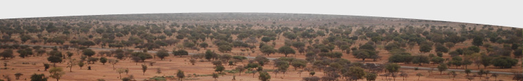
West Africa Sentinel Landscape (WASL)
The West Africa Sentinel Landscape is found within a transect that spans the NE of Mali, Burkina Faso, Northern, and Northern Togo. This transect also includes the Niger Basin and the Volta. The research will try to generate data on landscape performance over time, to permit identification and interpretation of these thresholds with respect to potential impacts on poverty, food security, human nutrition and sustainable natural resource management.
Western Ghats (India)
Agroforestry systems (coffee, tea, rubber, pepper, arecanut, cardamom) shape much of Western Ghats in India. Commercial agriculture in this area has existed for centuries. Now, these commercial crops have reached the margins of protected areas. In many cases, the only forests left are small sections which are either community-managed (i.e. sacred forests) or privately owned.
Western Amazon Sentinel Landscape
IMSAO covers the tri-national frontier region of Madre de Dios and Ucayali (Peru), Acre (Brazil), and Pando (Bolivia).A broad range of development conditions can be found. Acre is situated further along the economic development x-axis (higher economic development) and further down the forest cover y-axis (smaller area of forest cover) of the forest transition curve than the other three locations.
Cross Regional Sentinel Landscapes
Oil palm: Landscapes, market chains and investment flows
Over the past decades palm oil has become the first source of vegetable oil in the world. The growth in is mainly due to two Southeast Asian countries, followed others. The tremendous growth of palm oil was driven by an increasing demand for vegetable oil due to the global population growth, an increase of fat consumption and better living conditions.
Tropical Production Forests Observatory
The Tropical managed Forests Observatory (TmFO) is a new project that aims to assess the impact of logging on managed forest dynamics, carbon storage and tree species composition at a regional level in the Amazon basin, Congo basin and South East Asia.